Dams in Palakkad District
Palakkad is one of the agricultural districts of Kerala. Palakkad is known as the warehouse of Kerala as agriculture is the major economy of the district. Paddy is the main crop grown here. Therefore, dams are mainly constructed for irrigation facilities. There are a lot of dams here, big and small.How many dams are there in Palakkad district?
1.Malampuzha Dam.
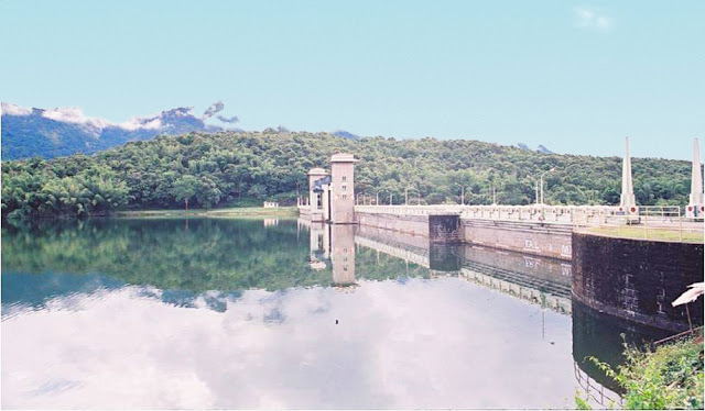
Malampuzha Dam is built across the Malampuzha River, a tributary of the Kalpathy River, the main tributary of the Bharathapuzha in Palakkad district of Kerala. It is the largest reservoir in Palakkad district. This dam was constructed as part of the Malampuzha Irrigation Project. Construction of the dam began in March 1949 and was completed in October 1955. The main benefits of the dam are irrigation and power generation. The authority to operate the dam is vested in the Kerala State Irrigation Department. The dam is 115.06 m high and 2,069 m long. The dam has four spillways. The total storage capacity of the dam is 236,690,000 cubic meters. Surface area 0.648 hectSurface area 0.648 hectares. The catchment area of the dam is 147.63 square km.
Malampuzha Reservoir and Malampuzha Garden are scenic. That is why Malampuzha Dam has become a major tourist destination in Kerala. Fantasy Park, the first amusement park in Kerala, is a major attraction near the Malampuzha Dam. There is a water theme park nearby. Malampuzha Dam is located at a distance of about 10 km from Palakkad town. Many visitors come here to see the dam and enjoy the natural beauty.
The Malampuzha Small Hydro Project generates a small amount of power from November to January using a 2.5 MW horizontal shaft caplan. Annual production is 5.6 MU. The machine was commissioned in 2011.
Major Attractions
Malampuzha Dam
Malampuzha Garden
Children's Park
Eco Park
Japan Garden
Speed boat ride
Fantasy Park
Freshwater Aquarium
Ropeway
Snake Park
Yakshi (Sculpture by Kanai Kunjiraman)
Suspension bridge
2.Pothundi Dam
Pothundi dam is located at Pothundi in Nenmara Grama Panchayat on the Nenmara - Nelliampathi road in Palakkad district. Pothundi Dam is a mud dam built on the Meenchadipuzha and Chadipuzha tributaries of the Ayilur river, a tributary of the Gayatri river, a major tributary of the Bharathapuzha. It is located at a distance of 42 km from Palakkad town and 8 km from Nenmara. Pothundi Dam is one of the largest earthen dams in India. The construction of the dam was started in 1958 by the then Governor Dr. R. Radhakrishnan Rao. It is 1672 meters long, 8 meters wide above the dam and 154 meters wide below. The dam is maintained by the Kerala State Irrigation Department. The dam was completed and opened in 1971.
Pothundi Irrigation Project has been prepared for agriculture and drinking water in Palakkad district. The benefit of this irrigation scheme is to the agricultural land to Chittoor, Nemmara, Alathur in Palakkad district and Vadakkancherry in Thrissur district. Nelliampathi Hills is located at a distance of 17 km from Pothundi. Nenmara Vallangi Vela is famous for its festival in the nearby town of Nenmara.
Other major attractions
Nelliyampathi
Nenmara
Nemmara Vallangi Vela
3.Parambikulam Dam
Parambikulam dam is located on the river that flows along the Parambikulam Wildlife Sanctuary in Muthalamada Panchayath, Palakkad District. This dam was built during the time of Kamaraj. It was one of the major irrigation projects planned during the Kamaraj period. There are a lot of crocodiles in the dam. Although the ownership of the dam belongs to Kerala, the dam is operated by Tamil Nadu. It is the largest embankment dam in India. Palakkad is bordered by the Western Ghats. The dam is 73.15 m high and 896.12 m long. Total storage capacity is 56,073 acre Ft. The dam was commissioned in 1976.
Parambikulam Wildlife Sanctuary covers an area of 285 sq km around the dam. The main road to Parambikulam also passes through Sethumada, 90 km from Palakkad town in Tamil Nadu. It is adjacent to the Anamalai Wildlife Sanctuary. Famous Top Slip is near Parambikulam. Thunakkadavu Dam and Peruvaripallam Dam are the nearest dams. The Parambikulam Dam is connected to the adjoining Thunakkadavu Dam by a 2.5 km long underground tunnel. The water stored in the dam is mainly used for agricultural purposes. Under the Parambikulam Aliyar project in Kerala and Tamil Nadu, 7.25 TMC of water is required annually from the proposed project which includes the dam. However, in 2004, Kerala did not have access to contract water, which caused damage to crops in the surrounding areas. The worst affected areas are Chittoor Taluk.
The water from the three dams will be diverted through the Sarkar Pathi Power Tunnel to the Sarkar Pathi Power House near Top Slip in Tamil Nadu to generate 30 MW of electricity using a 30 MW turbine. Current annual production is 162 MU.
4.Thunakkadavu Dam
The dam is located on the Thunakadavu River, a tributary of the Parambikulam River, at Thunakadavu, Parambikulam Wildlife Sanctuary, Muthalamada Panchayath, Palakkad District, Kerala. This small reservoir is part of the Parambikulam - Aliyar Irrigation Project. It is a small balanced reservoir with gross capacity is 557 MCFT. Nearby PeruvariPallam dam is connected to the dam by a canal. It is connected to the Parambikulam Dam by a 2.5 km long underground tunnel. The dam is 314 meters long and 26.91 meters high. The dam was completed and opened in 1965. Although the dam is located in Kerala, it is maintained by Tamil Nadu PWD.
5.Peruvaripallam Dam
Peruvaripallam Dam is located at Thoonakkadavu in Parambikulam Wildlife Sanctuary in Muthalamada Grama Panchayat, Palakkad District, Kerala. This is a small reservoir which is part of the Parambikulam - Aliyar Irrigation Project. The nearest Thunakkadavu dam is connected to the dam by a canal. The dam is 466 meters long and 27.74 meters high. The dam was opened in 1971. The dam is maintained by the Tamil Nadu PWD.
6.Chulliyar Dam
Chulliyar Dam is located in Muthalamada Grama Panchayat near Kollamkode in Palakkad district of Kerala. The dam was built on the Chulliyar River, a tributary of the Gayatri River, a tributary of the Muthalamada South Bharathapuzha. Chulliyar is a river that originates in the Nelliampathi Hills. This dam is mainly constructed for irrigation purposes. Chulliyar Dam area is quite a rural area. There are no tourism related projects here. The dam was constructed as part of the Gayatri Irrigation Project and the Palakapandi Irrigation Project. Chulliyar Dam and the surrounding area can be seen from the Sitarkund View Point in Nelliampathi. This dam was built for agricultural and drinking purposes. The dam is 1755 m long and 30.5 m high. The dam was opened in 1970. The dam is maintained by the Kerala State Irrigation Department.
7.Meenkara Dam
Meenkara dam is located in Muthalamada Grama Panchayat near Kollamkodu in Palakkad district. This dam is built on the Meenkara River, a tributary of the Gayatri River, a tributary of the Bharathapuzha in Muthalamada. Meenkara Dam is located at a distance of about 30 km from Palakkad town. The dam is approximately 964 m long and 18.9 m high. The dam is constructed and used for irrigation purposes. The dam offers mesmerizing views to the tourists. The dam is surrounded by forests and mountains. Apart from these, there are fish ponds, parks and gardens here. On the way to the dam, you can see the coconut groves and paddy fields of the locals. If you come in the evening, you can enjoy a nice sunset here. This is an ideal place for nature lovers and photographers. The dam was opened in 1960. Dam is maintained by the Kerala State Irrigation Department.
8.Mangalam Dam
The dam and the canal system on the left were completed in 1956. The construction of the canal was completed and the present canal system was opened in 1966. The dam is 1057 m long and 29.7 23 m high. The dam is maintained by the Kerala State Irrigation Department. Situated amidst dense forests, this place is rich in wildlife. Around the dam you can see a lot of animals coming to drink water and so on. This is the main attraction of the place. The dam has a capacity of 25.34 million cubic feet. The dam was built mainly for irrigation purposes. The area also has rubber, pepper, coffee and tapioca plantations. Surrounded by natural beauty, this place warms the minds of tourists.
Mangalam Dam is located in the south of Vadakkancherry Grama Panchayat, about 14 km from National Highway 544. A tourist park was also built on the scenic spot. In the forest near Mangalam Dam, you can see deer, wild boars, peacocks and various birds.
9.Kanjirapuzha Dam
Kanjirapuzha Dam is located in the Kanjirapuzha Grama Panchayat, near Mannarkkad in the Palakkad district of Kerala. The dam is located at Kanjirapuzha, a tributary of the Kunthipuzha, the tributary of the Bharathapuzha. The dam is located at a distance of 38 km from Palakkad town.This is a place of natural beauty. The dam is surrounded by a beautiful evergreen forest called Vetilachola. The dam is located at a distance of about 35 km from Palakkad via Thachambara ,Muthukurussi. You can reach this place by traveling 10 km via Mannarkkad. Adjacent to this dam is a garden called Kanjirapuzha Udyanam. Boat service and water transport in Kutta are available to tourists at the nearby Baby Dam. Vakkodan hill is located at a visible distance from the dam.
The dam was constructed as part of the Kanjirapuzha Irrigation Project. The dam has three shutters. Construction of the dam began in 1961 and was completed in 1995. The operating license of the dam is with the Kerala State Irrigation Department. The dam is 30.8 m high and 2,127 m long. The total storage capacity is 70.83 MCM. Catchment areas 7000 hectares. The surface area is 465 hectares. The normal elevation of the dam is 97.54 m.
This project irrigates 9713 hectares in Mannarkkad, Ottappalam and Palakkad taluks of Palakkad district. The State Fisheries Department sells fish in the reservoir. Shiruvani Dam can be reached by traveling 22 km along the right-hand lane at the entrance of the dam.
10.Walayar Dam
Walayar dam is located on the Palakkad - Coimbatore National Highway 47 at walayar in the Puthussery Grama panchayath. This beautiful dam built across the walayar river, a tributary of the kalpathy river. The dam construction was started in 1953 and Completed in 1956 as part of the Palakkad irrigation projects. But it was started in 1964. Walayar dam is also a major contributor to the irrigation of Palakkad. The dam is 20.42 m high and 1,478 m wide. The dam has a storage capacity of 18.4 million cubic meters. Jayaprakash Narayanan Deer Park is spread over an area of 120 acres.
11.Shiruvani Dam
Shiruvani Dam is located in Sholayur Panchayat, Attappadi block, Mannarkkad taluk, Palakkad district in the state of Kerala, India. The Shiruvani Dam is built across the Shiruvani River in the evergreen Shiruvani Forest. Permission from the Forest Camp is required to enter here and see the views of the dam. There is a Forest Department vehicle that can carry six or seven people to see the sights. During the journey, you can sometimes see animals like elephant, sheep, deer and monkey. Elephants can sometimes be seen swimming across this dam in the middle of the forest.
This dam is located in Kerala and is maintained by Tamil Nadu. The dam is 224 m long and 57 m high. The dam was opened in 1984. The water from the dam will be used for drinking water in Coimbatore, which is part of the Coimbatore Water Supply Project, after being treated in a water treatment plan at Singampathy in Tamil Nadu. The water supply to the dam comes from the waterfall from Muthikulam Hill on the eastern side of the dam. The water flowing down the dam joins the Bhavani River as the Shiruvani River. The 150 year old Pattiyar Bungalow is located on the banks of the Shiruvani Reservoir. In 1973, an agreement was reached between the State Governments for the supply of drinking water to the city of Coimbatore and adjoining areas. The dam is located in the state of Kerala and was implemented by the Kerala Public Works Department with funds from Tamil Nadu.
Shiruvani Dam is located at a distance of 46 km from Palakkad town. Shiruvani Dam is located at a distance of 22 km from the Kanjirapuzha Dam near Mannarkkad.


